Victoria’s Alpine Region (Winter) – Landscape Photography
Just back from a wonderful weekend away with my beautiful wife.
We stayed at Ted’s High Country Lavender Farm in Porepunkah. Gorgeous wood fire mud brick cottages are set on a large property with magnificent views of Mt Buffalo and Porepunkah’s surrounds.
In the summer, purple lavender covers the ground. In winter, the farm offers a great romantic mud brick cottage hideaway. The cottages have spas, wood fires and are self contained, a fantastic rustic getaway.
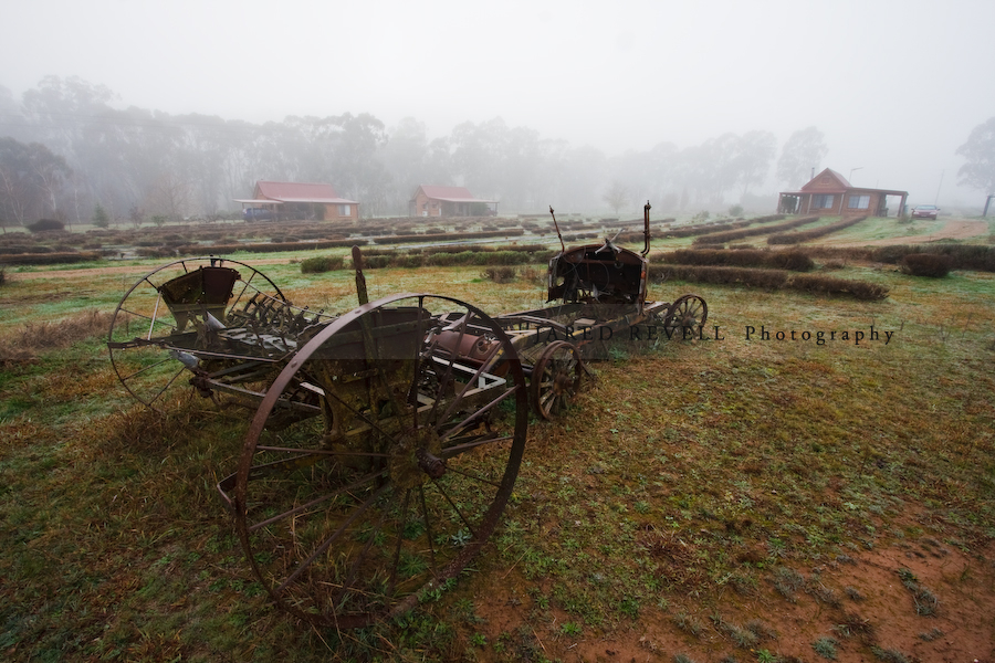
This time of year brings cold, frosty nights, and the wood fire is a must. The crisp mornings are just beautiful as the frost and fog takes overs the land.
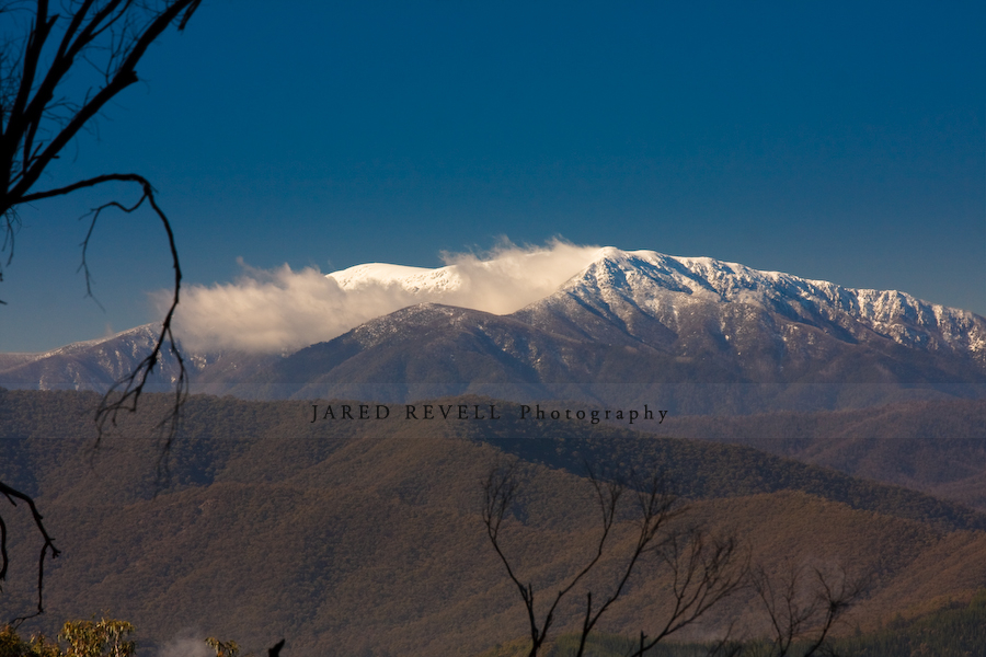
Winter brings plenty of snow to the mountains in Victoria’s alpine region. On clear days, you can see snow capped peaks in the distance. Snow lovers travel up north to hit the alps to ski, toboggan or hike.
For those not into the recreational activities, traveling to the region just to see the marvelous views is sufficient, there’s something for everyone.
Mount Buffalo National Park (see www.parkweb.vic.gov.au for more info) stands tall as the dominant mountain south along the Great Alpine Rd from Myrtleford, Ovens, Eurobin, Porepunkah and along to Bright. The mountain has spectacular granite cliffs, endless waterfalls and enormous, deep gorges.
Lying on the western slope of Mt Buffalo is the massive Lake Buffalo. It is a popular fishing, water skiing and picnicking venue.

This time of year, carrying snow chains is compulsory. The main road is often snow-covered from McKinnons Corner through to Cresta Valley.
In winter, the road to “The Horn” (the peak of Mt Buffalo at 1723m) is closed due to the road being snowed under. Skiers can enjoy a day at Cresta Valley, while hikers can venture around other areas of the park as there is over 90km of tracks. We hiked up “The Hump” track to the Cathedral.
Starting at the Cathedral Picnic Area, the “Hump track” track is covered in snow in winter, but worth the climb for spectacular views of Cresta Valley and the Horn.
 |
 |
On the climb up or down, make sure you stop and check out Torpedo Rock. This unbelievable ‘torpedo’ shaped rock sits on another and looks amazing in winter with the ground covered in snow and a vibrant blue sky.

On the climb down the mountain, we walked the Eurobin Falls Track, which passes Ladies Bath Falls along the way. Just round the bend from the walking track is the Eurobin Falls Picnic Area which is also a lovely spot to stop and view the water running at full force this time of year.
 |
 |
")
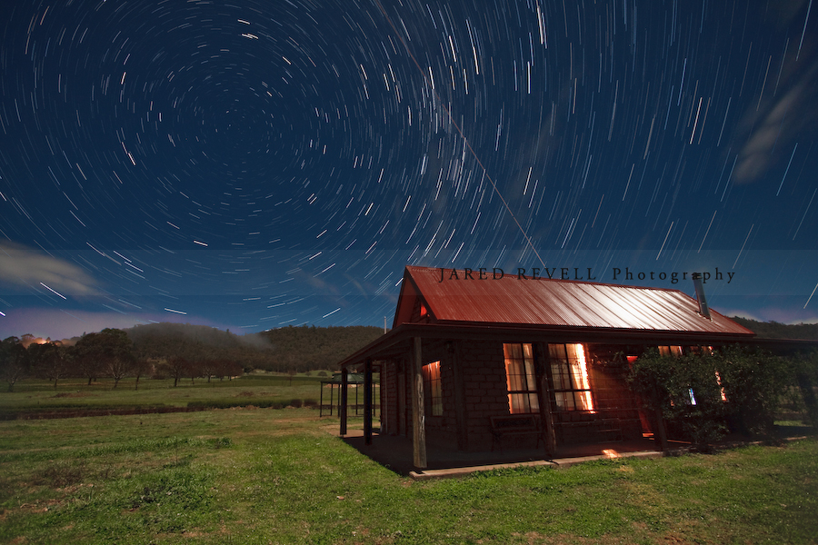
The nights in the Alpine Region get very chilly indeed, especially on clear nights. Below is a 30 minute star trail photo before the fog started to drift over the valley, fogging up the lens as well !
A trip to this region wouldn’t be complete without stopping at one or many of the local wineries. Without doubt, the most popular from the King Valley wine region is Brown Brothers.
The family owned and run Brown Bothers produces the largest range of wines in Australia. You can be sure every time you go, there will be something new and exciting to taste and buy.

Victoria’s Alpine Region (Summer) – Landscape Photography
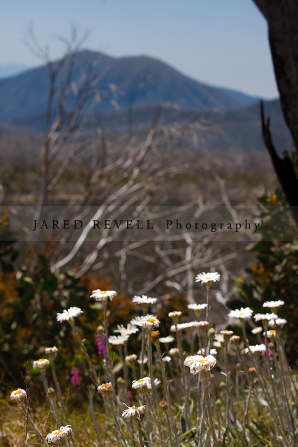
Wild flowers come to life in Victoria’s Alpine Region during summer.
During certain times, fields are covered in them, depending on the weather conditions. This year I didn’t see endless fields, but there were plenty of flowers on show displaying their vibrant colours and hardiness.

|

|

The mountains have many tracks for four wheel drivers to attempt, and many winding roads. Mountains and valleys dominate the land in this region always provide spectacular views.
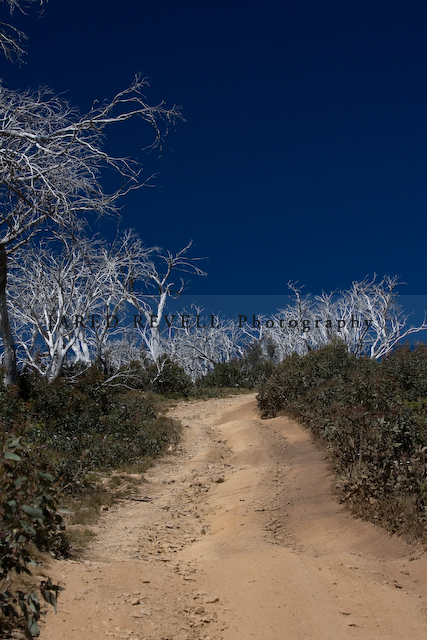
This year, the stark white trees were a reminder of the terrible bush fires that the region is prone too. But the beautiful wild flowers and new growth provided a reminder that the cycle continues and the local flora and fauna was returning.
|
|
During summer, venturing up to the peak of Mt Buffalo at sunset is definitely worth the drive. Approximately 1 hour from Porepunkah, the lookout at The Horn Picnic Area has breathtaking views. You can just sit back and watch in amazement as the sun goes down behind the ranges, colouring the sky and exposing the sheer grandeur of the region. Layers and layers of ranges can be seen in shadow.
During twilight, a walk up to The Horn is something special. At 1700m, The Horn is the highest peak at Mt Buffalo. A popular spot for rock climbers, it also offers magnificent views both during the day and at night. Make sure you bring a torch and you’re not afraid of bats or moths !

|

|

Mt Buffalo offers so much for outdoor enthusiasts. The air is fresh and the steep rising granite cliffs, grand. Wildflowers flourish in amongst the snow gums.
At dawn and dusk, keep your eye out for native animals such as wombats, wallabies and lyrebirds. With over 90km of walking tracks, summer is a great time to get outdoors and trek. Mountain biking, canoeing and swimming are just a few of many other activities on offer during the warmer months, see www.parksweb.vic.gov.au for more information.
Tumbling waterfalls aren’t as prevalent in summer, but it makes for ease of access across Eurobin Creek at the base of the mountain.
")
|

|
Accommodation is scattered all throughout the region and there are plenty of places to choose from depending on your budget. This summer, my family stayed at Ted’s High Country Lavendar Farm.
Purple covers the ground and it’s a perfect location for both couples and families. Set on a few acres, the farm offers a great getaway as well as plenty of room for kids to get up to mischief and get to know the local animals like Ted’s donkeys, chickens and sheep to name a few.

|

|

Consisting of four river basins or valleys, created by the Ovens, Buffalo, Buckland and Kiewa rivers, this region’s high altitude, hot summer days and cool nights allow its small vineyards to make distinctive wines (sourced from www.visitvictoria.com).
Wineries in the region are a perfect place to have a delicious lunch and try many of the fabulous wines on offer from the region.
During summer, Feathertop Winery’s cafe is open and offers a wonderful selection of local produce for lunch, as well as fantastic wine.

|

|
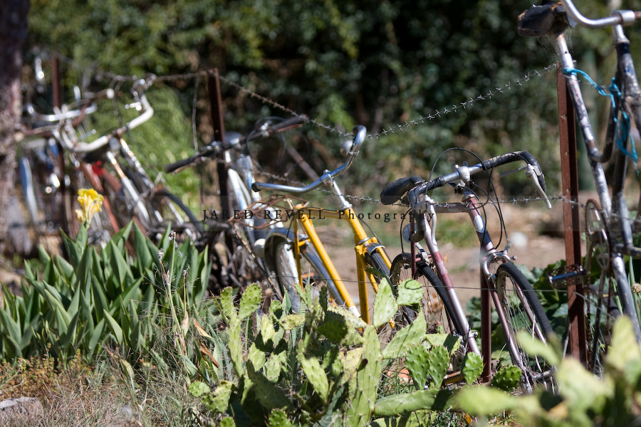
And on your return journey…keep an eye out for the never ending views, or even just interesting yards !
Star Trails
On our recent trip to the Grampians, Neil and I did some late night star trail photography at Lake Fyans.
A few people have asked me how I did it, so I thought I’d share my information with you all.
 |
|
With digital cameras and remote shutter releases, it’s fairly straightforward to take star trail photos. I recommend taking multiple shorter exposures and merging them because digital sensors build up heat over long exposures, causing red/purple casts to appear at the edges of the sensor and ruining your shot. Using shorter exposures is a way around this.
For my photos above, the details are below.
Camera Settings
Camera: Canon 40D
Lens: EF-S 10-22mm
Focal Length: 10mm
Aperture: f4.0
ISO: 800
Shutter Speed: 30 seconds x 114 shots & 111 shots
WB: Auto White Balance
Format: RAW
Tripod
Remote shutter release cable
Drive mode: Continuous shooting (burst)
Focus point on the tree (using a torch to illuminate the tree to get the focus point)
Processing
Step 1: (RAW file adjustments to all 114 shots)
Exposure adjustment: +0.9 (to get the exposure level I was after)
Exported the 114 shots as JPEG
Step 2: (Merging photos)
There are a couple of methods of doing the photo merging.
Achim Schaller has written a wonderful Startrails Application to merge all exposures into one JPEG.
It also can create a time-lapse movie ! (see mine below)
Another method is to use Photoshop and combine all layers using “lighten” merging. A handy and time saving method is to use Chris Schur’s Photoshop action.
Step 3: (JPEG Adjustment)
Sharpening (50%)
Noise Reduction (100% colour & luminance)
Celestial Positioning
Depending on what effect you are after, compose your shot accordingly.
For my photo above, I composed the shot using the south celestial pole (see image below sourced from wikipedia) which give the circular effect.
The north and south celestial poles are the two imaginary points in the sky where the Earth’s axis of rotation intersects the imaginary rotating sphere of stars called the celestial sphere. The poles appear directly overhead to an observer at the North and South Pole’s.
For those living in the southern hemisphere, there are a few methods to find the south celestial pole.
Southern Cross Method
The south celestial pole can be located from the Southern Cross and its two pointer stars.
Looking up at the Southern Cross, draw an imaginary line from the two stars at the extreme ends of the long axis of the cross and follow this line through the sky. You can either go four and a half times the distance of the long axis on the Southern Cross in the direction the narrow end of the cross points, or join the two pointer stars with a line, divide this line in half, then at right angles draw another imaginary line through the sky until it meets the line from the Southern Cross. At this crossing point is the south celestial pole.
Magellanic Clouds Method
Using the Magellanic Clouds clouds in the southern sky, make an equilateral triangle, the third point of which is the south celestial pole.

Compass Method
Using a compass, locate true south and point up to an angle equivalent to your latitude.
For example, if you were in Melbourne CBD (-37.814056,144.96168), then using your compass facing true south and looking up at an angle of 37.8° will give you the south celestial pole.
Celestial Movement
Below is a compiled video of all of my 114 exposures from Lake Fyans in the Grampians, showing the celestial movement around the south celestial pole, located at the end of the tree’s branch. (Thanks to “Achim Schaller” for this wonderful application).
You’ll notice too that the light seems to fade on the lake and the tree goes in shadow. This was because the moon was behind us and was fading to the horizon over the hour of exposure. Also the bright light appearing across the lake at the end of the sequence was a car.
For a great article on Night Sky Photography from NightSkyPix, showing it’s not that difficult to get into the hobby, see this link:
How To Photograph Star Trails – We Show How Easy It Can Be To Capture Your First Star Trail Photo